Overlaying cell tower data and LiDAR for search & rescue
When someone goes missing in rough country, the land holds clues — and so does their phone. We turn raw LiDAR into a terrain model and read it together with the last faint traces of a mobile signal, to point searchers at the likeliest ground first. When minutes matter.
Sharpening the last-known position from a phone's idle signal
A phone that's switched on but not in a call still quietly checks in with the nearest mast every so often. That faint, idle signal is often enough to place someone — if you can read it against the ground they're walking.
The moment a phone moves from one mast to the next narrows things down. Each mast can tell roughly how far away the phone is — a band, or arc, at a set distance. Where the arc from the old mast and the arc from the new one cross, you get a small patch of likely ground: far tighter than "somewhere near this tower".
After that, the phone settles on whichever single mast it hears most strongly and stays locked to it — until that signal weakens or drops out. Those changes aren't random. A signal fades or cuts when something solid comes between the phone and the mast: a person walking down into a steep gorge, slipping behind a ridge, or passing through or behind a building. Thick vegetation does it more gently — a forest canopy doesn't block the signal outright, but it makes it weaker and patchier. A brief drop that comes straight back usually means a short, passing obstruction.
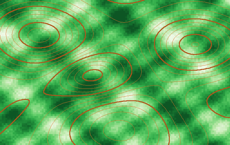
Each tower gives a distance from how long the signal takes to travel (timing advance / round-trip time) — but only to within a band: roughly 78 m on a good LTE network, out to ~550 m per step on older GSM. Cross three towers (multilateration / TDOA, ~50–300 m) and the bands meet in a small probable-location patch. Terrain still bends the picture — the signal travels near line of sight, so ridges and gorges distort the rings. Illustrative; ranges per findcellid and InfiShark.
What each obstacle does to the signal
Seen side-on, the three obstacles leave three different fingerprints — which is what makes them tellable apart. A clear line from the tower to the phone carries a strong signal; break that line and the signal suffers in a way that matches the thing breaking it.
A clear line of sight is what carries the signal; each obstacle interrupts it differently. And the rate at which the signal fades is itself a clue — it tracks how fast the person is moving toward or away from the tower (their speed relative to the tower, not over the ground).
Why LiDAR makes the signal readable
On its own, a drop-out is just a gap. Laid over a LiDAR terrain model it becomes a clue. Knowing exactly where each mast stands and how tall it is, we can work out — contour by contour — where its signal should fade or cut out across the landscape. The same LiDAR maps show where the canopy is thick enough to weaken a signal.
Line the real pattern of drop-outs up against those predictions and a story starts to form: the phone went quiet here, which fits someone walking into this gorge; the signal got patchy there, which fits crossing that band of dense forest. Put together, the idle signal and the terrain can narrow a wide search down to a likely route — and rank where to look first.
Worked example: spot height 188 on a real LiDAR sheet
Here's the idea on real ground. Take the hill at spot height 188 and imagine a mast on top. Looking west, the land falls away into a steep gorge — and anything not in a straight line back to 188 loses signal. The deeper into the gorge on the 188 side, the more likely the phone drops out entirely; climbing the far wall, it can rise back into view and pick up again. Vegetation adds to the picture: the pale, lightly wooded ground out along the Pindar Walking Track holds a signal far better than the dark, dense canopy.
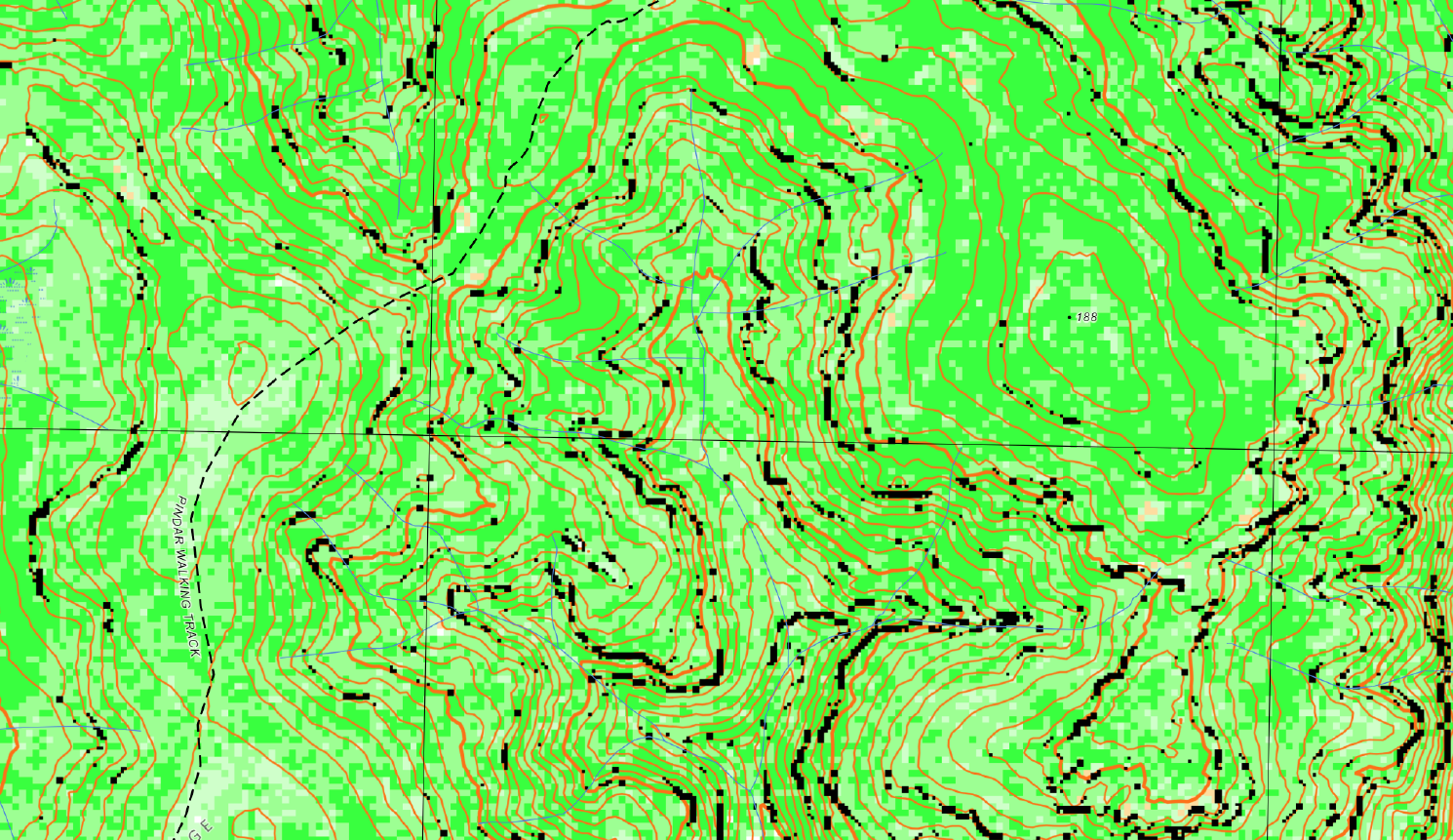
An illustrative line-of-sight reading laid over the real LiDAR sheet — not a computed viewshed. The mast at 188 is assumed for the example. Zones show where terrain (the gorge) and canopy would most likely weaken or drop an idle phone's signal; a full version would compute the shadow from the elevation model and each mast's real height.
Hardware the searchers could carry
Part of the proposal looks at gear teams could take into the field: a backpack-sized device — an IMSI catcher, sometimes called a "stingray" — that acts like a cell tower, so nearby phones try to connect to it and briefly reveal they're present. Carried by a search team, it could pick up a missing person's phone at close range, even where there's no normal coverage. This is sensitive kit, tightly controlled, and any use would sit firmly within the same approvals as the data work.
How far it reaches depends heavily on the country. In open terrain a backpack catcher might detect a phone from 1–2 km away. Push into thick forest and that collapses to roughly 50–250 m: foliage soaks up and scatters the radio signal, so the device has to be far closer to hear a phone at all. That ties straight back to the LiDAR — the dense canopy it maps, the same patches that weaken a normal tower signal, also shrink the searcher's own reach. So the map doesn't just say where the person might be; it says where teams must walk a tighter, slower grid, and where they can sweep faster as the bush opens up.
Read the full research proposal → — objectives, methodology, data & legal strategy, risks and phasing.
Research in progress — seeking a sponsor & approval
This is a research proposal, not a finished tool — we're looking for a sponsor to take it forward. Whatever it becomes, it stays grounded in the real terrain and the last-seen evidence, ranked transparently, with a human coordinator in command: the tool points at likely ground, people decide. Cell-tower data is tightly regulated too — only certain authorities and emergency services, under the right circumstances, are allowed to access it. We're seeking both a sponsor and the approvals needed to continue the work, so it can be done lawfully and in the right hands.